Sheet A-105In progress
St. Elizabeths East Campus
Adaptive Reuse and Sustainable Urban Design
Plates
5 platesSt. Elizabeths East Campus, in Congress Heights in Southeast Washington, is one of the most significant redevelopment opportunities in the District. Built from the mid-19th century as part of the historic St. Elizabeths Hospital, the 118-acre campus sits where architectural heritage, steep topography above the Anacostia, fragmented open space, and aging infrastructure meet — next to the Congress Heights Metro station.
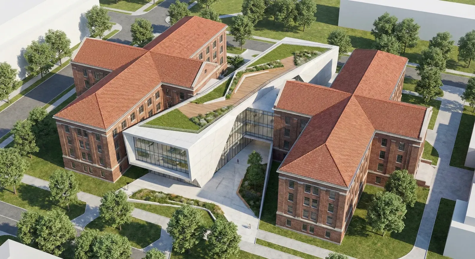
The proposal treats adaptive reuse as a low-carbon strategy as much as a preservation one. Two cruciform ward buildings are retained in full and converted to studio housing, joined by a new faceted connector that shares amenity between them without displacing historic fabric. Reusing structurally viable buildings keeps their embodied carbon, their cultural memory, and the continuity of the community around them.
Three site systems
The project pairs the buildings with three district-scale systems drawn from The Sustainable Urban Design Handbook:
- Stormwater and green infrastructure: green roofs on the reused buildings, bioswale corridors that follow the natural fall toward the southeast low points, rain gardens in courtyards and plazas, permeable paving, stormwater capture for irrigation, and restored drainage paths.
- Urban canopy and ecology: a continuous tree-canopy spine linking the north and south of the campus, native species suited to the Anacostia watershed, pollinator planting within stormwater features, and shade along pedestrian routes.
- Multimodal mobility: a central pedestrian promenade between campus nodes, protected bike lanes, micromobility hubs, less surface parking, and a mobility loop connecting housing, community space, and the Metro.
One integrated network
The systems reinforce each other. Stormwater corridors double as ecological corridors; canopy shades the walking routes; pathways run alongside bioswales and planted zones; and the reused buildings anchor the network with green roofs, solar infrastructure, and public-facing program. Mixed-income housing and access to public green space carry the social side of the same plan.
Path to implementation
The proposal works within existing tools: the STE District zoning and Historic Preservation Review Board guidance for the historic structures, DOEE stormwater retention standards and the Green Area Ratio, DDOT's Complete Streets policy and WMATA coordination for transit, and Inclusionary Zoning and community land trusts for long-term affordability.