Sheet A-101Complete
Restoring the Jewish Temple: A Spatial Study
Evidence-Based Historic Restoration & BIM/GIS Integration
- problem
- Historic restoration of a contested sacred precinct required reconciling fragmentary archaeological evidence with architectural precision — without displacing standing fabric.
- method
- Built an evidence hierarchy, then combined BIM modeling, GIS control data, Monte Carlo testing, and iterative drawing studies to bound what the evidence supports.
- output
- A documented restoration model, analytical diagrams, coexistence studies, and a navigable image archive.
- tools
- Revit, PyRevit, QGIS, PyQGIS, Python, Twinmotion
Plates
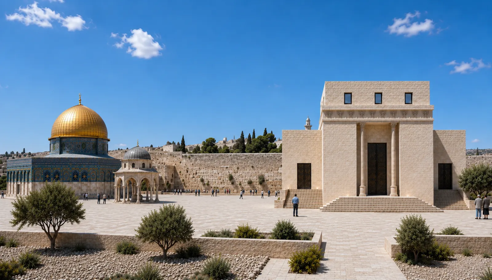
14 platesA historic restoration study that treats one of the most contested reconstruction questions in architecture as a testable geospatial problem. Rather than beginning from inherited placement traditions, the project built an evidence hierarchy — textual, archaeological, and architectural sources translated into measurable constraints — and asked a narrow question: do the spatial relationships surviving on the existing platform converge in a statistically meaningful way when tested against uncertainty? The output is a bounded candidate zone, not a location proof. The analysis supports the plausibility that the Foundation Stone belongs to a wall of the Herodian temple courtyard rather than the sanctuary itself, placing the restored Temple on the east–west axis of the Golden Gate, approximately 80–100 meters east of the Dome of the Rock. The restoration proposal is governed by minimal intervention: every existing structure on the platform is retained in situ, no standing fabric is displaced, and the precinct is framed as shared sacred space rather than a site reclaimed from its present custodians.
Challenge
Practicing historic restoration on a living, contested heritage site where the primary evidence is fragmentary, the surviving fabric is sacred to multiple communities, and no intervention may displace what already stands.
Approach
All geometry was consolidated into EPSG:32636 (WGS 84 / UTM Zone 36N) within QGIS and PyQGIS. A five-stage workflow moved through data preparation, observed-model construction, Monte Carlo uncertainty modeling, null-orientation comparison, and leave-one-out sensitivity testing. Dual-environment validation — primary construction in QGIS, independent blind retest in a Python repository — reduced the risk of results being artifacts of the GIS session. The observed constraints converged more tightly than randomized orientation models, defining the candidate zone against uncertainty. The architectural translation follows conservation practice rather than conjectural rebuilding: surviving fabric is treated as fixed datum, restored geometry is derived only where the evidence carries it, and the reconstruction is legible as an interpretation rather than a replica. The result adopts a Haggai-era register — a modest restoration under constrained circumstances rather than a maximal Herodian reconstruction — expressed through parametric cubit-based overlays, footprint and altar-offset studies, and processional axis diagrams anchored to the eastern gate alignment.
Outcome
Built a multi-scalar restoration workflow that connects archaeological evidence, geospatial analysis, and architectural modeling into a clear visual argument — and a siting proposal that adds to the platform without subtracting from it.